Browser-based flight planning
DJI drone mission planner for mapping surveys
Turn a survey boundary into a structured flight grid without switching between a desktop GIS, spreadsheets, and chat attachments. FlyPath keeps planning inputs, route estimates, and mission export in one browser workflow.
Planning assistance does not replace airspace checks, local regulations, site assessment, or the pilot’s pre-flight review.
Planning workflow
From survey boundary to a reviewable route
A mapping route is more than a set of waypoints. The boundary, altitude, side overlap, front overlap, speed, capture mode, camera timing, and return action all affect whether a mission is practical. FlyPath exposes those inputs together so a survey planner can see how a change influences the route before creating a file.
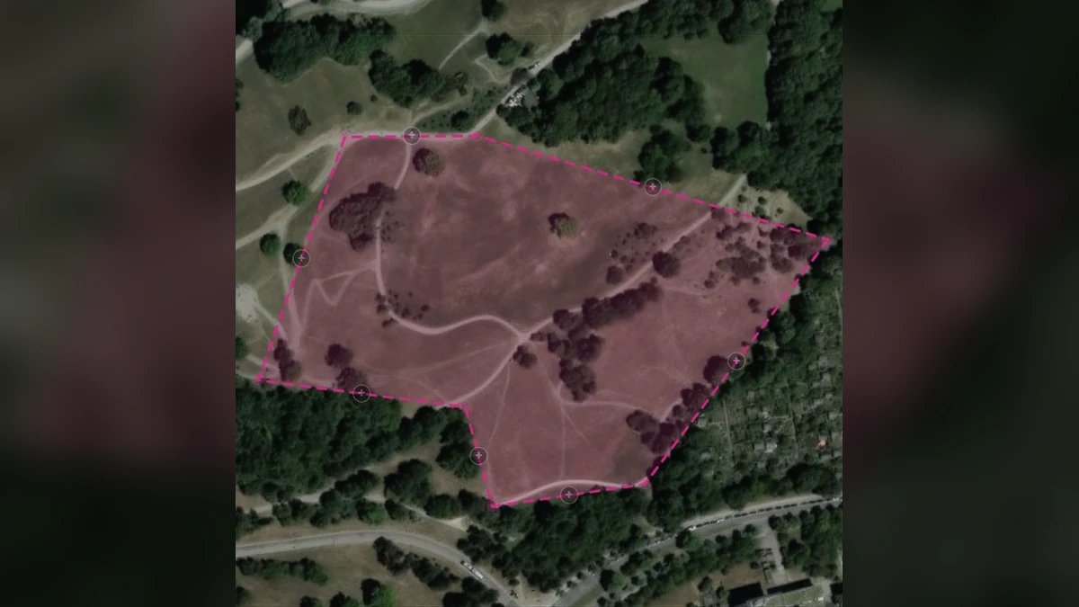
Draw the target area or import a KML boundary. FlyPath generates parallel capture strips and reports values such as approximate survey area, photo count, ground sample distance, strip count, and estimated flight time. The planner can then review mission and safety settings before exporting.
Core capabilities
Tools for repeatable drone mapping plans
Map-based survey design
Draw a polygon around the site and generate a lawnmower-style mapping grid directly in the browser.
Aircraft-aware estimates
Use planning profiles for DJI Mini 3 Pro, Mini 4 Pro, Mini 5 Pro, Air 3, Air 3S, Mavic 3 Classic, and Mavic 4 Pro. Matrice 4E export remains in validation.
Capture mode, overlap, and GSD
Choose semi-auto or full-auto capture, then adjust altitude, speed, and overlap while watching the mission and capture estimates change.
Mission review before export
Review altitude, boundary margin, finish action, and controller-loss behaviour before generating the mission file.
DJI output
Export a WPML-compatible KMZ mission
FlyPath packages the planned route as a KMZ containing DJI WPML mission data. A KMZ is a compressed container; WPML is the mission description inside it. Keeping that distinction clear makes it easier to validate the output and understand which controller or DJI application is expected to consume it.
Compatibility can vary by aircraft, controller, firmware, and DJI application. Always review the imported route on the intended controller, confirm waypoint altitude and actions, and perform a conservative field test before using a generated mission operationally.
Questions
DJI mission-planning FAQ
Which DJI drones have planning profiles?
The current FlyPath interface includes profiles for DJI Mini 3 Pro, Mini 4 Pro, Mini 5 Pro, Air 3, Air 3S, Mavic 3 Classic, and Mavic 4 Pro. Multi-camera aircraft must use the wide mapping camera. Matrice 4E support is still being validated. Pilots must verify every exported mission with their exact aircraft, controller, application, and firmware.
Can I import an existing boundary?
Yes. The planner supports KML boundary import so a site outline prepared elsewhere can become the starting geometry for the mapping route.
Does FlyPath check airspace or legal permissions?
No. The pilot and operator remain responsible for airspace authorization, local flight rules, weather, obstacles, site access, and every other operational safety decision.
Free beta